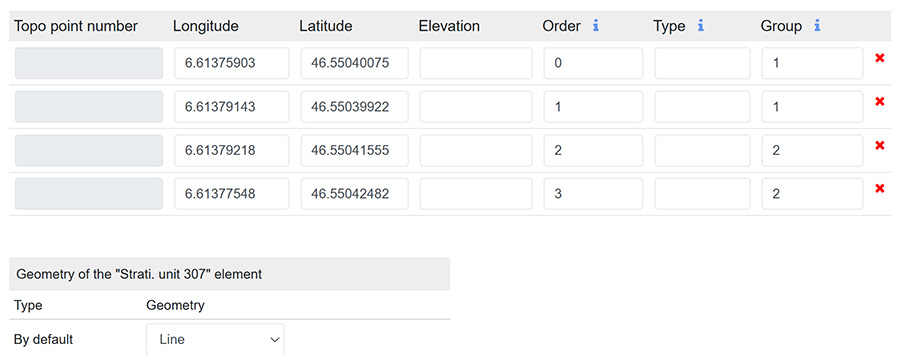
Manual entry of coordinates can be done from a form by selecting Coordinates in its dropdown menu  .
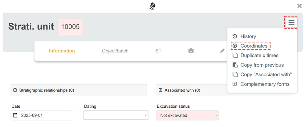
Coordinate input window
The coordinate input window consists of three distinct elements:
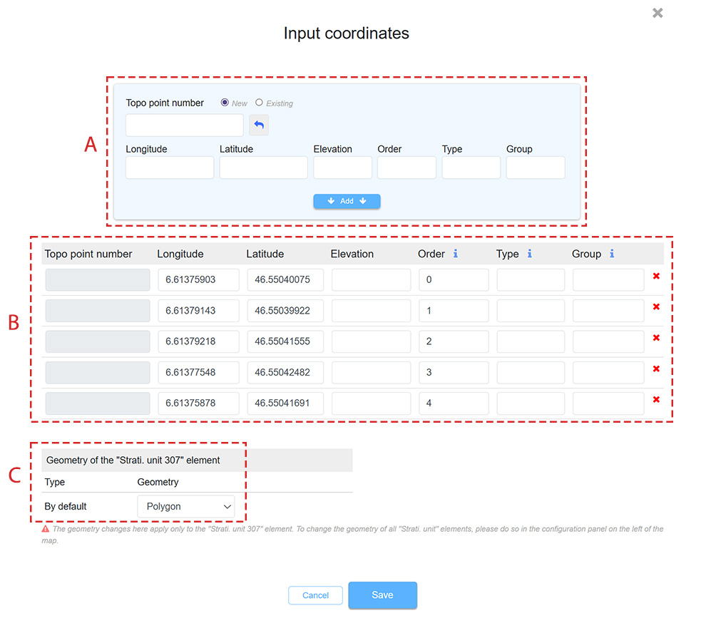
| A | Coordinate input window |
| B | Table of entered coordinates |
| C | Default geometry |
Minimal input
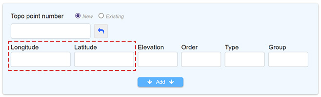
A minimal input can be made by entering only the Longitude and Latitude coordinates. The format of the entered coordinates must match the coordinate system previously defined for the intervention.
Optional fields
Topo point no.
A set of Longitude - Latitude coordinates represents a Topo point. It is possible to assign this Topo point a unique identifier called Topo point no.
 |
|
 |
|

In practice, it is possible to generate Topo point nos. without immediately attaching coordinates to them. These coordinates can be recorded later with a theodolite that mentions in an Excel file the Topo point numbers with their respective Longitude and Latitude. During the import, a match is made based on the existing Topo point nos. within ArcheoBase and the Topo point numbers mentioned in the file to be imported.
Altitude
The altitude of each Topo point can be entered.
Order
This field allows you to enter a number that defines the order of coordinates in a geometry. It is only useful if the actual order of Topo points that make up the geometry differs from the natural display order of Topo points shown in the table.
This allows, for example, to create well-formed polygons whose segments do not intersect, in case the successive capture of a geometry’s coordinates was not done in a clockwise or counter-clockwise direction. This often occurs when points are captured in a zigzag manner, alternating point captures from one side to the other of a trench.
Type
This field allows a specific geometry to be assigned to coordinates sharing the same Type value. These coordinates can be grouped by assigning them a specific letter or number.
In the example below, coordinates of type C will be displayed as circles, other coordinates of type L as lines, whereas by default (empty value) coordinates are displayed as points.
A single form can thus have several different geometry types displayed on the map.
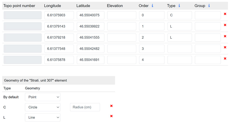
Note that in this case, the radius of the circle can also be defined. This can be useful for generating geometries related to post holes, for example.
Group
The Group option allows you to group different coordinates together, unlike the Type option which is limited to assigning specific geometries.
Each group represents a distinct geometry. In the example below, the default geometry is Line. The Group option makes it possible to define two separate lines on the map, as the coordinates are grouped by number. A letter could also have been used instead of a number for this grouping.