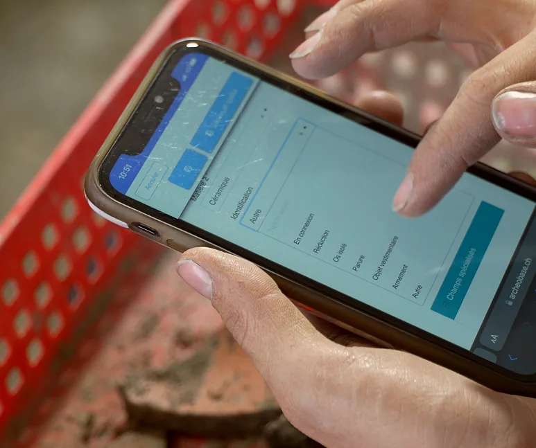
Advanced 2D Drawing Tool
CAD precision, purpose-built for archaeology
All the precision your documentation demands, without the cost and complexity of CAD software.
From quick sketch to technical drawing
From rapid field annotations to publication-ready 2D technical drawings, the tool adapts to every visual documentation need. Layers, assisted drawing, coordinates, and measurements, everything is integrated into a single environment.

Drawing essentials
- Freehand: pencil, line, polyline, circle, and eraser
- Stroke color and thickness configuration
- Drawing aids: auto-close lines, automatic path cropping, continuous line mode, freehand writing, auto-incrementing numbering, and tolerance settings
- Fills: pattern selection, fill color, and angle

Annotation built for archaeologists
- Customizable icon library for recurring archaeological symbols
- Text elements with font, size, weight, and color settings
- Configurable markers: shape, color, auto-numbering or free text, comments and optional links to a form

Layers and media
- Layer management: visibility, order, and style overrides
- Photo import with transparency, rotation, resizing, scaling, and GPS positioning
- Grid system: configurable square size and quantity, GPS-positioned
- Distance calculation and geolocated reference points
Georeferenced by design
The drawing module operates in a flexible 2D environment, in plan view or section view, with a coordinate system adaptable to your excavation context. All coordinate systems are supported, including custom systems defined via Proj4.
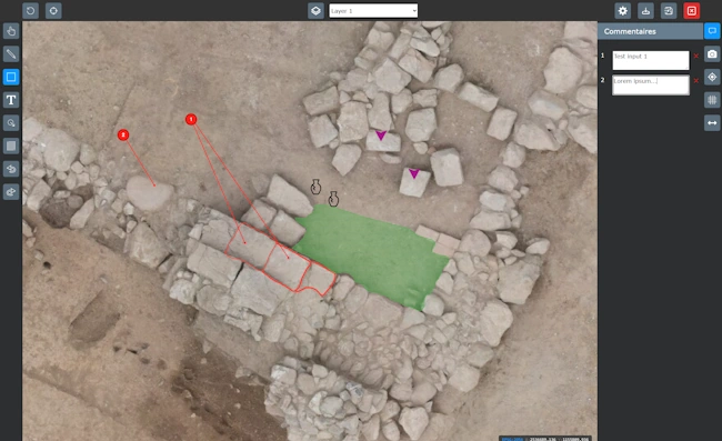
Draw on your photos, in real coordinates.
Georeferenced images, such as GeoTIFF or image files with a world file (JGW and similar formats), are imported directly and position themselves automatically in the drawing space. Ordinary photos can be positioned by defining two reference points and their coordinates; for angled images, perspective correction (manual or automatic) is available using four georeferenced control points. Either way, you can draw directly over the image, in real coordinates.
Measure as you draw.
Integrated tools let you accurately measure distances, add reference points, and retrieve the exact coordinates of any point in the drawing.
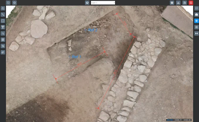
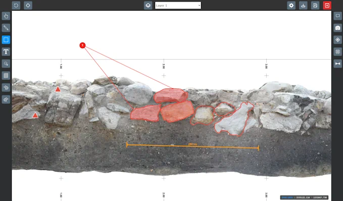
Plan view and section view.
Both are native. Section drawings integrate with the map through dedicated section geometries, keeping vertical documentation connected to its exact location on site.
Connected to your records, not floating in a folder
A drawing in ArcheoBase is archaeological data: linked, numbered, and searchable like everything else.

Every element linkable to a form.
Link any shape, annotation, or marker to a stratigraphic unit, artifact, or structure. From any form, its drawings are one click away.

Automatic numbering.
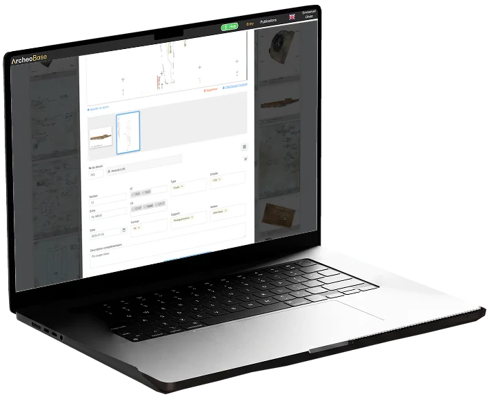
Drawings save into dedicated forms with an auto-assigned number. No registers, no duplicates.

Paper sketches included.
Scan hand drawings and upload them into the same forms, alongside vector drawings: one numbering system, one searchable archive. PNG, JPG, TIFF, PDF, AI, EPS, PSD, DWG, and more.

Browse like your photos.
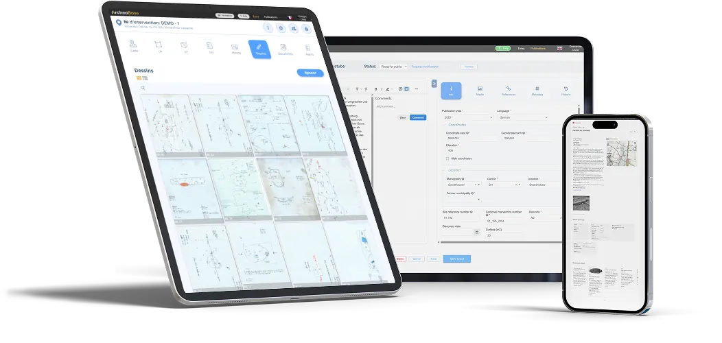
Mosaic or table view, filters by any form field or linked element, full edit history.
Exports that respect your work
Whatever you draw stays usable, in your reports, your publications, and your GIS.

Take it with you.
Export drawings as SVG with coordinates retained, a standalone vector file ready to open in QGIS, ArcGIS, or any layout tool.

Or connect live.
Drawings can be served as raster layers via GeoServer for seamless integration into external GIS systems.

Publication-ready files.
Export in SVG, PDF, or JPG for reuse in reports, articles, or layout tools.

Straight to the map.
Send drawings directly to the excavation map as layers alongside your orthophotos and geometries.
Benefits
A complete graphic environment, from sketch to technical precision.
Draw, annotate, and create 2D surveys directly on your photos or site plans, with tools suited to every situation.
Clear and consistent visual structuring.
Thematic layers, standardized symbols, and customizable styles make drawings easier to read, interpret, and reuse.
Seamless integration with archaeological data.
Every graphic element can be linked to a form, ensuring total consistency between drawing and database.
Uncompromising spatial precision and interoperability.
Integrated georeferencing, measurement tools, perspective correction, and GIS exports keep your drawings scientifically usable everywhere.
Ready to draw without complicated software?
Free calibration to your methodology.
Free field test. No commitment.