Features
From the first field form to the published chronicle, ArcheoBase covers the complete workflow without switching platforms, reformatting data, or losing context.
 Search
2D Drawing
Structured Recording
Harris Matrices
Coordinate Entry
GIS & Maps
Publication
Photos & Drawings
Data & Access
Structured Recording
Forms configured to your methodology
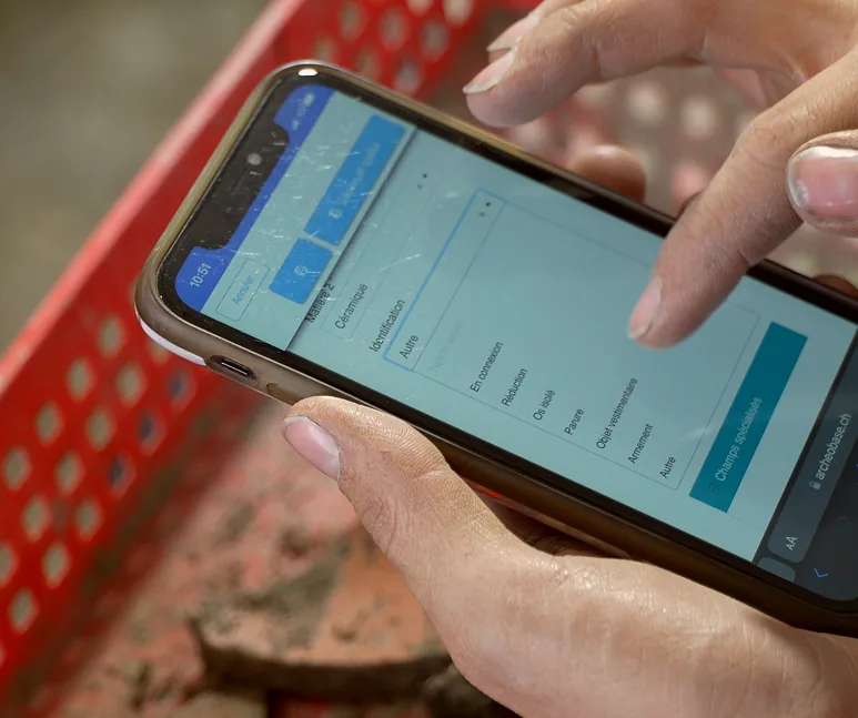
ArcheoBase allows teams to record field data using customizable digital forms that reflect their own documentation standards. Existing paper forms are converted into digital formats while preserving methodological choices.
-
 Customized fields and tab structures
-
 Controlled vocabularies and thesauri
-
 Explicit relationships between records
 Spatial Area
Structure
Find
Photo
Drawing
Your customisable forms
Digital forms can be reused across projects and shared within or between institutions, ensuring consistency without imposing uniformity.

Relationships at the core
Relationships between stratigraphic units, structures, artifacts, photos, drawings, and spatial areas are recorded once and reused everywhere. Direct relationships are entered explicitly; indirect ones are inferred automatically.

Full traceability
Every modification is recorded, and each form includes a complete edit history. Earlier versions remain accessible in read-only mode, ensuring transparency, accountability, and long-term auditability across the entire project lifecycle.
GIS & Maps
Archaeological data and cartography in one environment.
Spatial data is no longer managed separately from field records. Coordinates, geometries, and maps remain directly connected to the archaeological information they describe.
Read moreInteractive GIS Maps
Display all georeferenced data instantly: GPS surveys, site plans, orthophotos. Click any geometry to access its associated record. Advanced search filters the map by any recorded property or relationship: show only the postholes of one phase, or every unit associated with a given structure.

High-Definition Orthophotos as Map Layers
Import georeferenced orthophotos directly into ArcheoBase. Servers automatically tile them for smooth, high-definition display, even on tablets in the field. Once imported, orthophotos become selectable background layers on your map, providing an accurate visual reference alongside your excavation geometries. When multiple orthophotos are available, layers can be reordered by drag-and-drop, making it easy to compare different acquisition dates or processing stages. Both plan-view and section-view orthophotos are supported.

Interoperability with External GIS Tools
ArcheoBase provides configurable WFS services, allowing real-time visualization of excavation data in QGIS, ArcGIS, and other compatible tools. Institutions control which attributes are exposed, ensuring interoperability without loss of structure, meaning, or authority over the data. External raster or vector layers, such as cadastral parcel maps or historical cartographies provided by state services, can also be called into ArcheoBase via WFS or WMS, serving as additional background maps directly on the excavation map.
Coordinate Entry
Four ways in
Total station, GNSS receiver, GIS file, spreadsheet, a stylus on the map, or a keyboard in the trench: every excavation measures differently, and often several ways on the same day. ArcheoBase accepts them all, and every coordinate lands directly on the record it describes.

GNSS / Total station
Survey points from total stations and GNSS receivers keep their full precision in your national or custom grid, and each measurement takes its place on the map and on the record it belongs to.

Import
Point files straight from total stations, GNSS receivers, or theodolites (CSV, XLSX), plus existing GIS files and spreadsheets, including legacy datasets. A reference column in the file (e.g. ‘ST 1415’) links each point to its form automatically, and imported geometries appear on the map immediately.

Draw
Points, lines, and polygons drawn freehand directly on the excavation map (on a tablet at the trench edge, if you like), with HD orthophotos or site plans as the visual reference underneath. Each geometry is assigned to its record as it's drawn, and displays with the styling you choose: color, transparency, layer.

Type
Coordinates entered manually within any recording form, in your own coordinate system, whether a national grid or a custom one. Documentation keeps moving even when no measuring equipment is at hand, and hand-entered positions can be corrected or replaced later in bulk.
Photos & Drawings
Linked media, not isolated files.
Photos and drawings are treated as archaeological data. Each image has its own structured record and can be linked to any other entity, giving immediate contextual access without browsing folders.
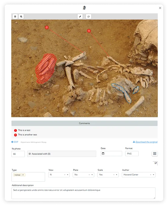
Structured data for every photo
Each photo carries its own metadata record (date, type, author, associated unit) and links directly to the stratigraphic or find records.
With no limit on the number of photos, drawings, or documents, ArcheoBase is built to handle the full scale of institutional archives, from single interventions to decades of fieldwork across thousands of sites.
AI-based board recognition
During import, ArcheoBase automatically reads visible identifiers in photos, such as stratigraphic unit numbers, and associates images with the correct records. This reduces manual sorting significantly.
Read more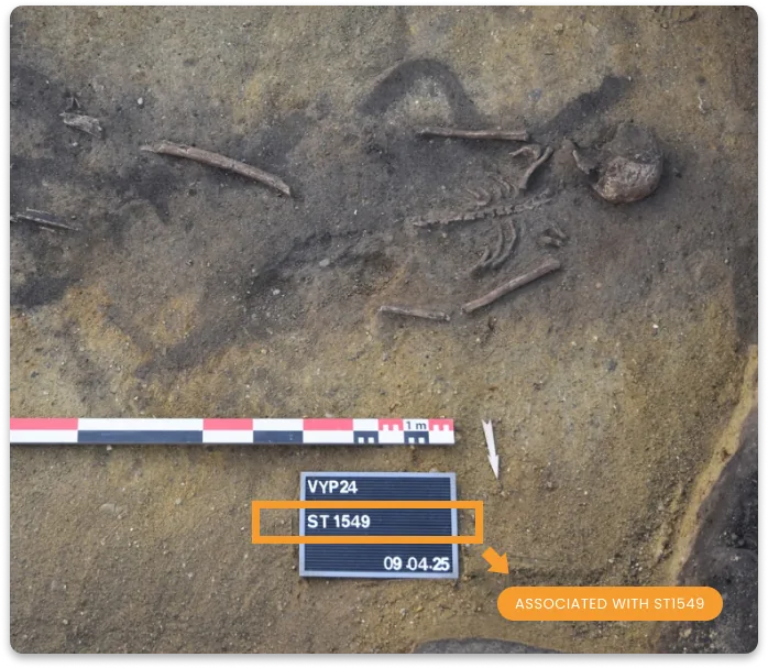
2D Drawings
CAD precision, purpose-built for archaeology.
A web-based 2D drawing environment designed for archaeological documentation. Georeferenced, layered, and linked directly to form data.
-
 2D georeferenced environment
-
Layers
-
Link vectors directly to form data
-
Export as SVG, PDF, JPG, or straight to the map
-
Advanced tools: icon library, coordinates, grid, hatching
Avoids the cost and complexity of CAD software while delivering scientific-grade precision.
Harris Matrices
Generated automatically
from your records.
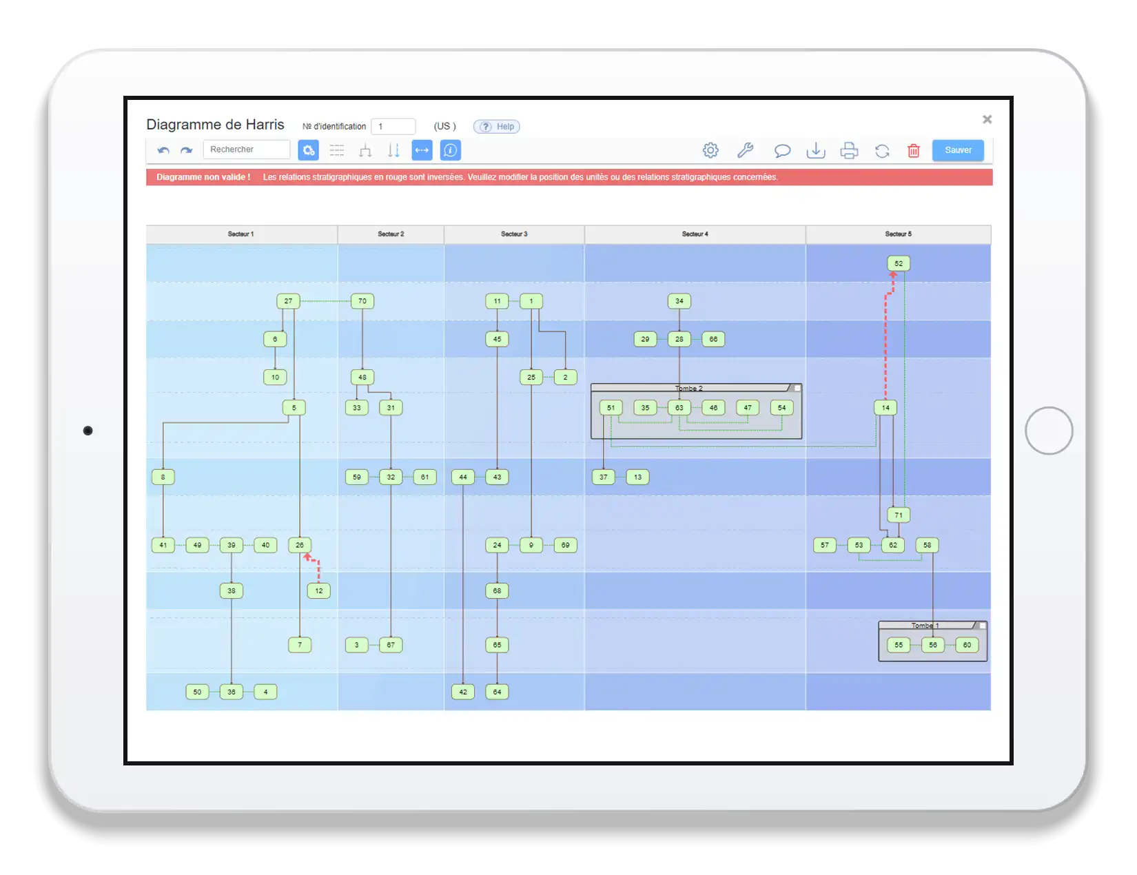
Harris Matrix creation is now fast, intuitive, and interactive. Generate a complete matrix in a single click.
- Generate in one click
- Automatic detection of inconsistencies
- Manual adjustment when required
- Sync with underlying records
- Export as vector graphics
Publication
From structured data to scientific dissemination
The Publication module covers the entire journey from first draft to live web reporting or publication. No Word files. No email threads. No lost versions: every author, reviewer, and editor works on the same document.
One workflow, draft to online
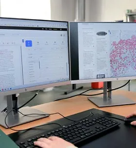
Each publication type (chronicle, excavation report, or scientific article) follows its own dedicated workflow with validation steps for procedural and editorial consistency.
6,900+ chronicles online
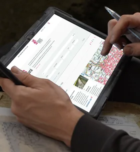
Swiss Archaeology used the Publication module to bring its national archaeological chronicles to the AS Portal. Over 6,900 entries, 1987–2024, are live and searchable today.

Draft

Internal review

Editorial validation

Publication

Live on portal
Data & Infrastructure
Your data. Your control. Your peace of mind.

Cloud storage
AWS-hosted, enterprise-grade security, accessible anywhere.

Zero IT burden
ArcheoBase manages servers, updates, and maintenance.

Automatic backups
Your data continuously protected against loss.

Local backup option
Export all data tables, photos, and media in standard formats.

Permissions per excavation: control consultation, editing, and administration rights per user and role.

Dedicated workspaces: each institution in a fully isolated environment with shared spaces for cross-institutional collaborations.

Flexible team management: handle permanent staff, external specialists, and temporary workers easily.
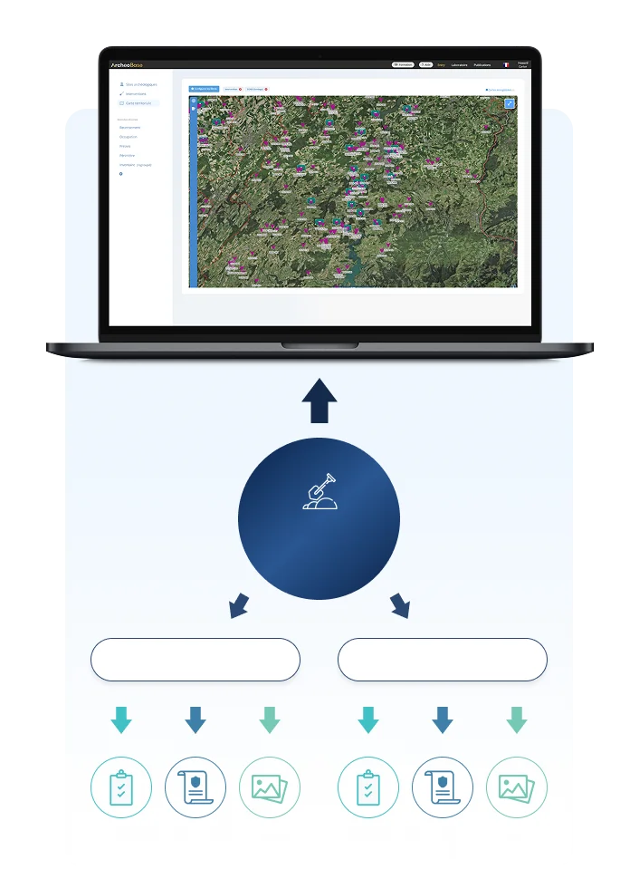 Archaeological site
Intervention 1
Intervention N
Form Data
Documents
Media
Form Data
Documents
Media
Search
Search at every scale
Search across a single intervention, a whole archaeological site, or your entire territory, and combine spatial and attribute queries at any level, from one find to a region-wide overview.
Three nested levels (intervention → site → territory) so data rolls up without ever being re-entered.
Planning for the long term?
Book a demo to see ArcheoBase today and talk
through the roadmap and timelines.
Free calibration to your methodology.
Free field test. No commitment.